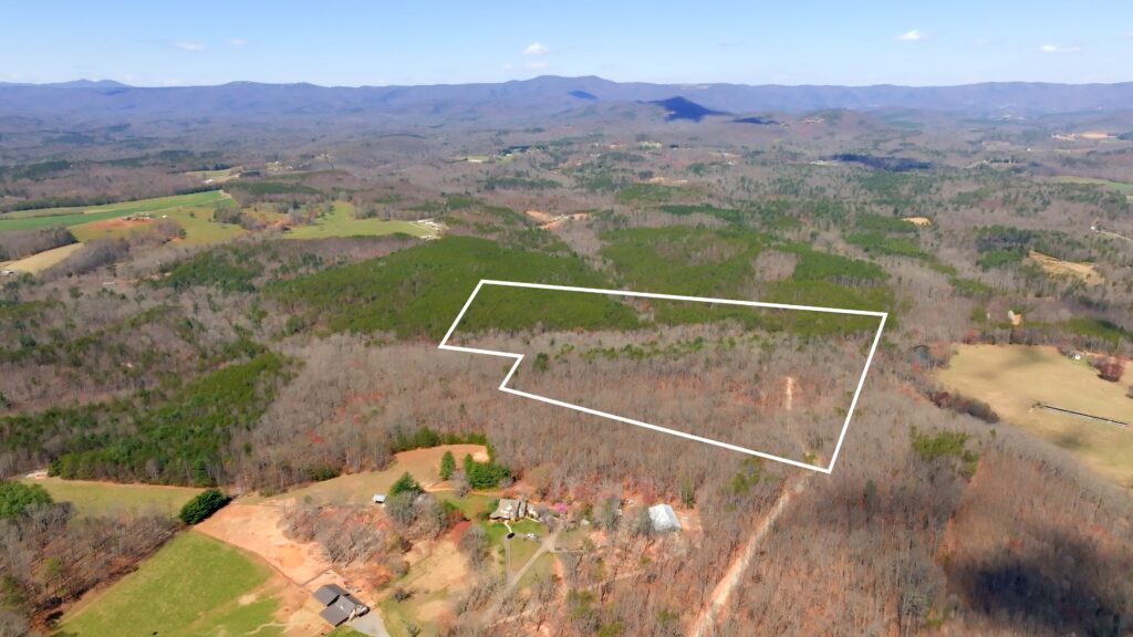
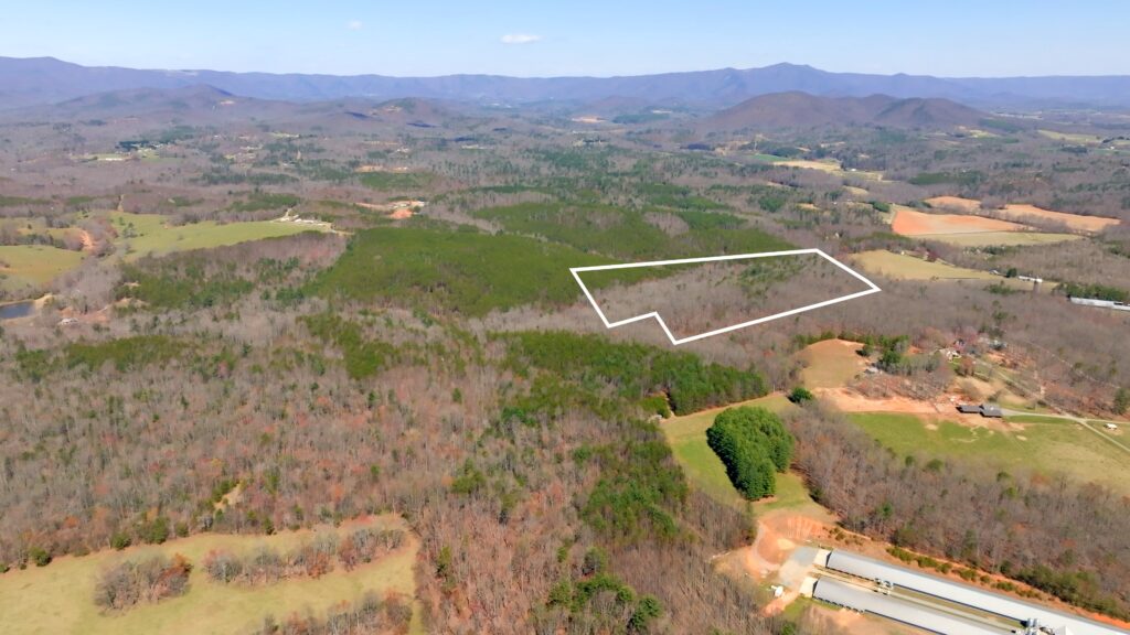
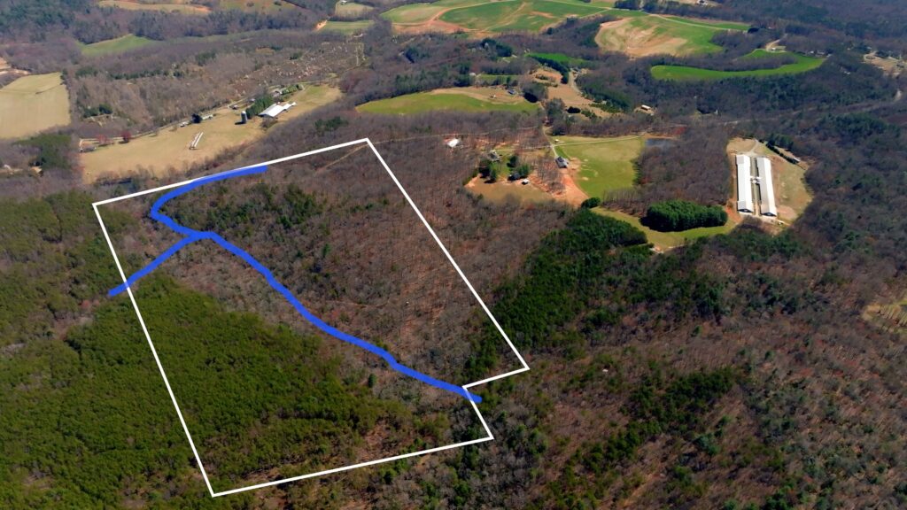
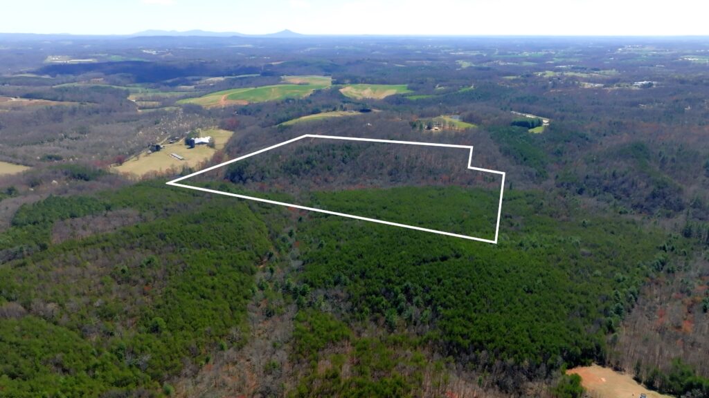
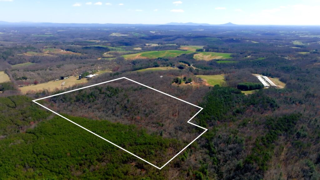
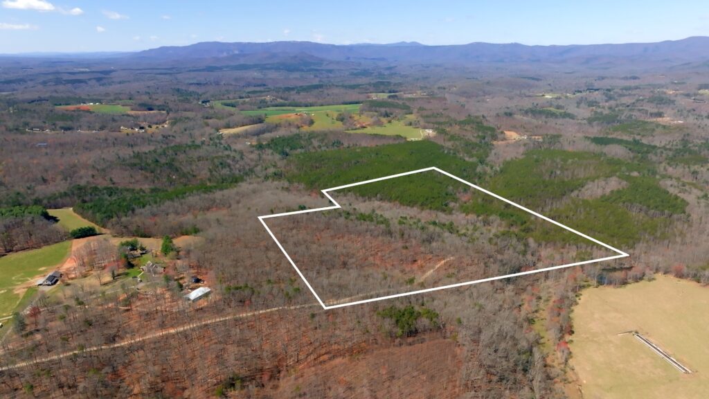
Exceptional opportunity to own 56.6 unrestricted, private acres nestled in the picturesque Fisher River Valley of Surry County, North Carolina. This property combines natural beauty, privacy, and development potential—all just minutes from major amenities and recreation.
Property Highlights
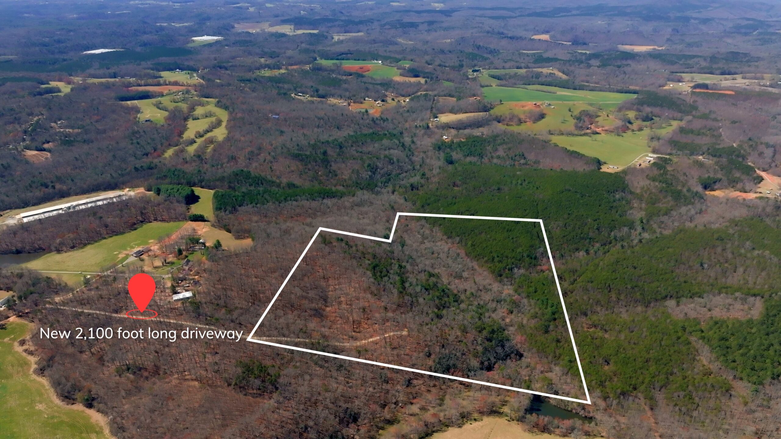
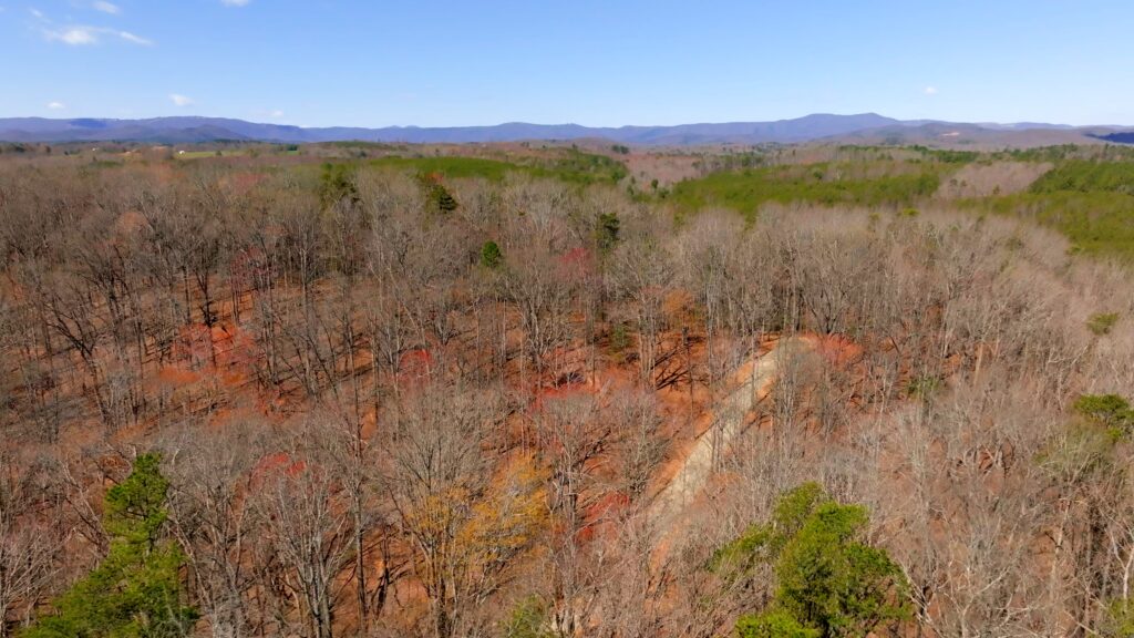
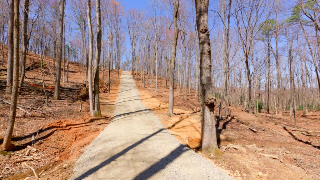
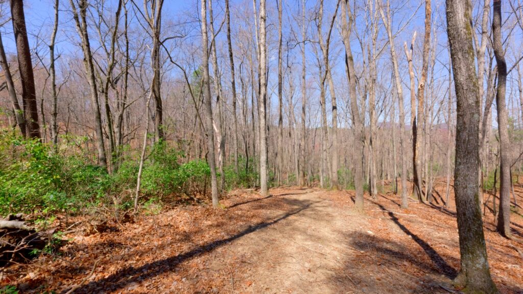
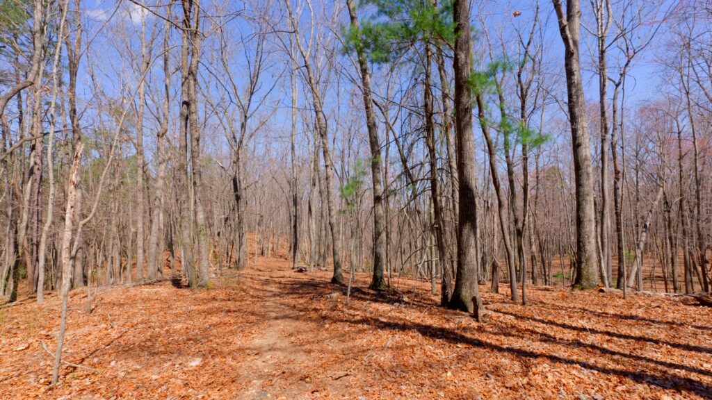
- Private Gated Entrance and Driveway: A newly constructed 2,100 ft gravel driveway winds through mature forest, leading you to the peaceful middle ridge of the property.
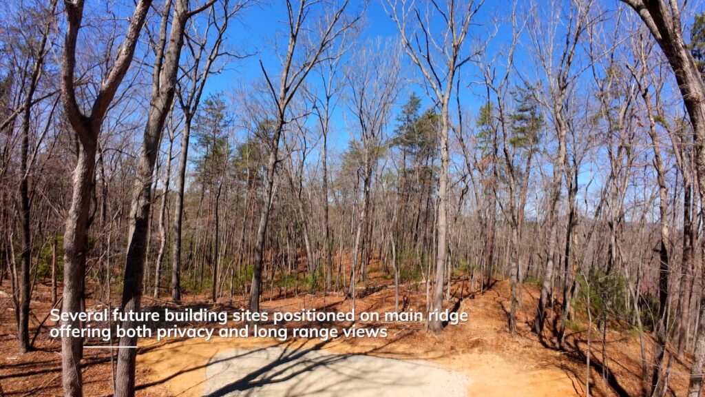
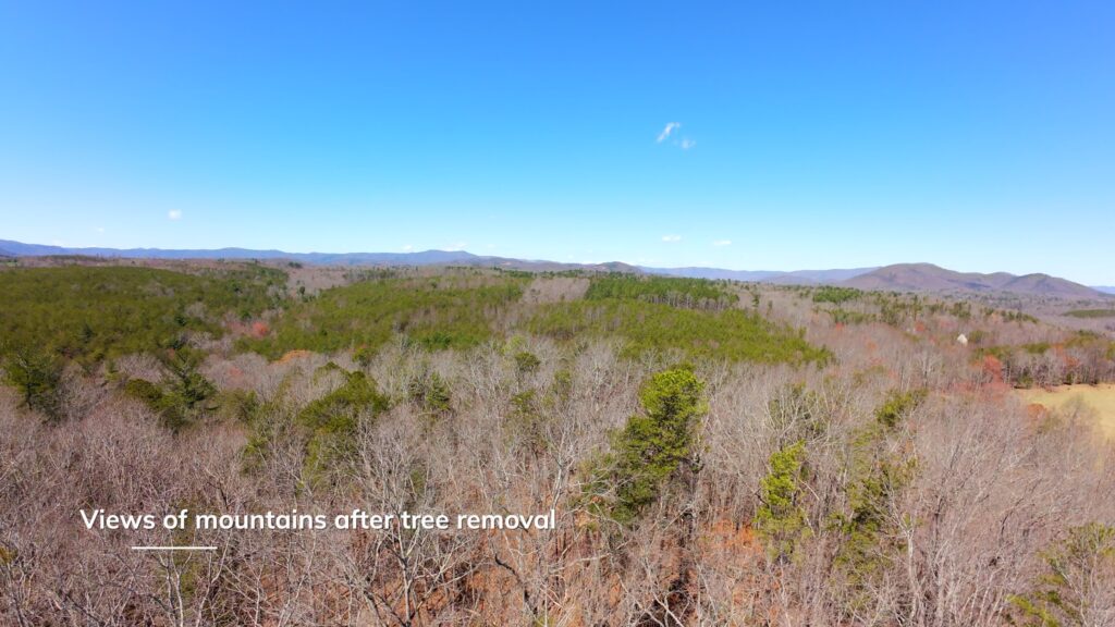
- Multiple Building Sites: Choose from several prime building locations with long-range mountain views during leaf-off seasons or year round views with tree clearing.
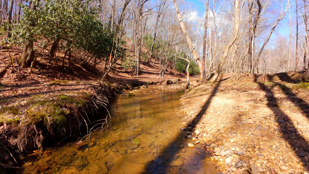
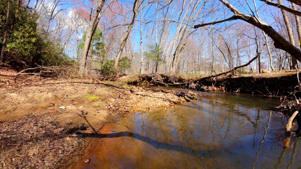
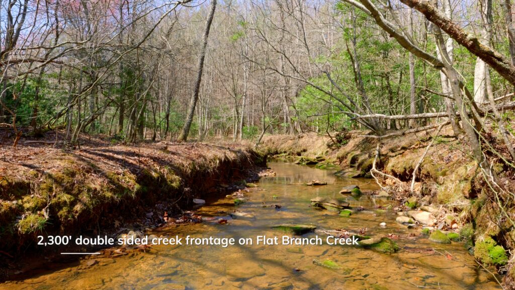
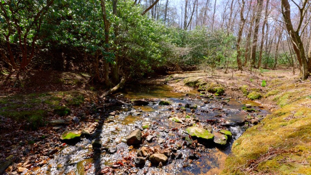
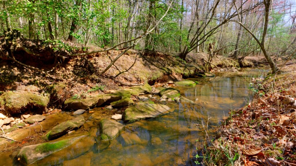
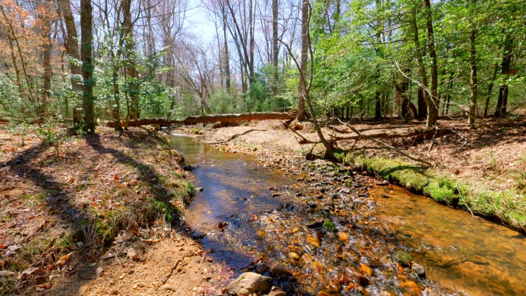
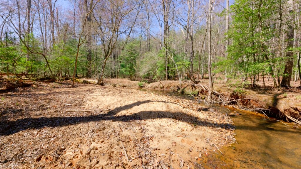
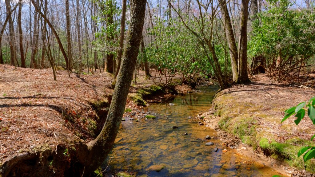
- Exceptional Water Features: The western half of the land is predominantly flat, offering 2,300 ft of double stream frontage along Flat Branch—renowned as one of the most beautiful creeks in the area.
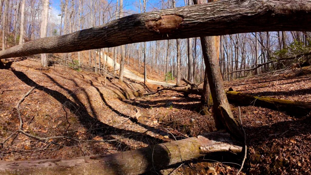
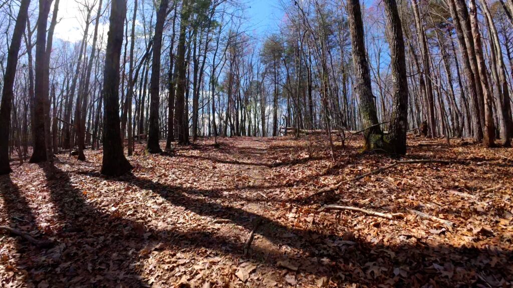
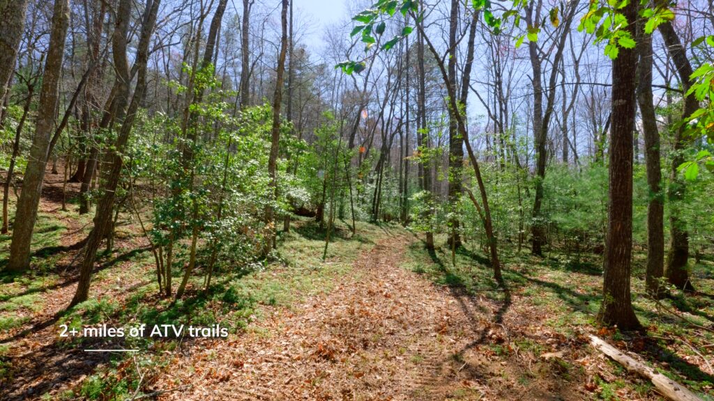
- Extensive Internal Trail System: Approximately 2 miles of well-maintained trails ideal for side-by-sides and ATVs, ensuring easy access to every corner of the property.
- Recent Survey & Approvals: A new 2025 boundary survey is complete and a 5-bedroom septic permit is already in place, streamlining the building process.
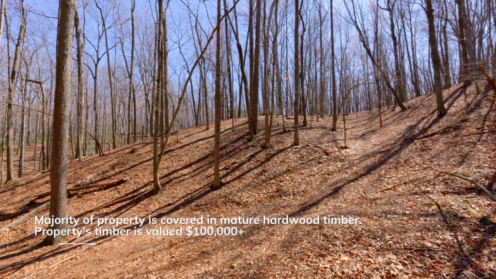
Natural Assets & Timber Value
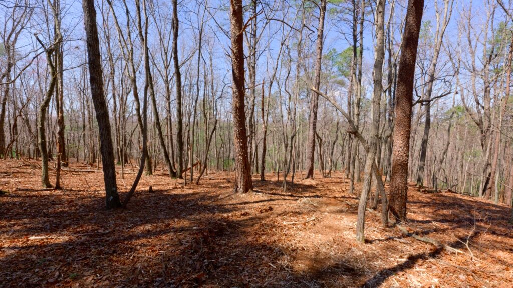
- Valuable Timber: The land boasts timber valued at over $100,000, primarily mature hardwoods mixed with some scattered pines—most trees exceeding 75 years of age.
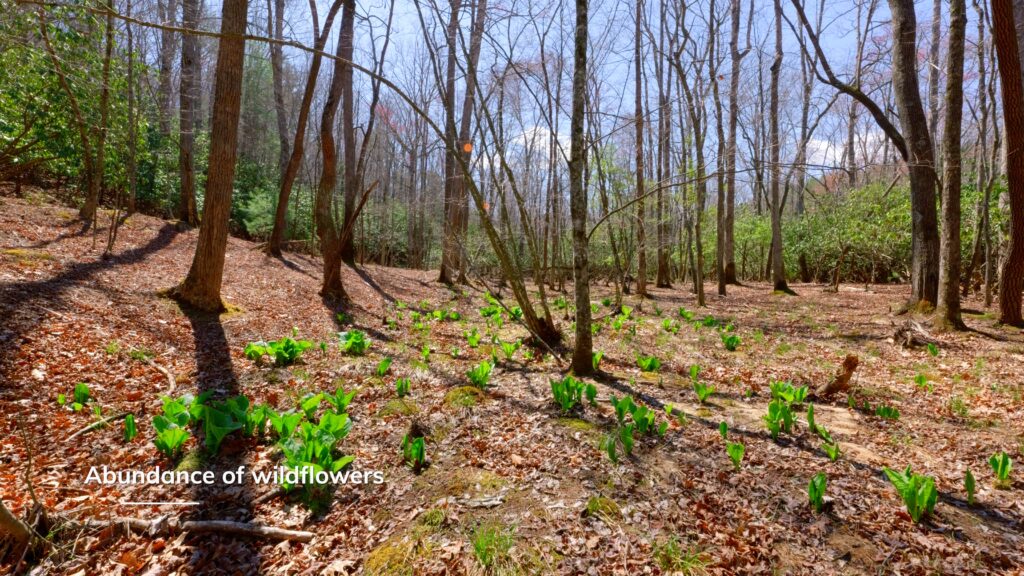
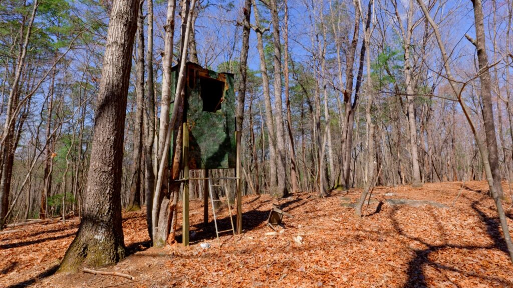
- Wildlife & Outdoor Exploration: Abundant wildlife, peaceful woodlands, and scenic water features provide exceptional opportunities for recreation, hunting, and relaxation.
Development Potential
- Soil & Subdivision Readiness: Favorable soilsl for septic systems—allow for the possibility of further subdividing into multiple homesites if desired.
- Future Growth: Ideal for a private estate, multi-home family compound, investment holding, or residential development.
Prime Location
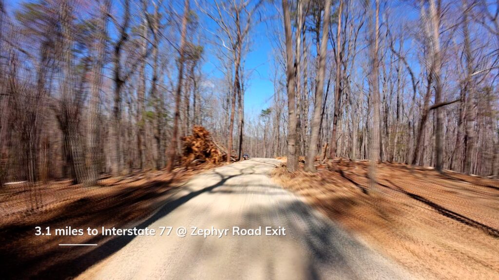
- Only 3 miles to Interstate 77 for quick regional access.
- A short 10-minute drive to Fisher River Park and public trout fishing, placing outdoor recreation at your doorstep.
- Located in a serene, rural corridor while still convenient to nearby Dobson amenities and year-round activities.
This rare property offers a combination of unmatched privacy, natural splendor, and outstanding versatility, making it a unique find in the sought-after Fisher River Valley. For further details or a private tour, don’t hesitate to reach out. Agent is owner.
Property Video
(play full screen for best quality)
Uses
Farming, Hunting, Investment, Recreational, Single Family Residential, Timber
Parcel Information & Price
| Tax Parcel ID # | Size (ac) | Price | Status |
| 496800518869 | 56.6 | $299,900 | Sold |
Property Features
- 56.6 acres
- No deed restrictions
- Supreme privacy and seclusion
- Option to further subdivide
- New 2025 survey
- New 2025 5-bedroom septic permit
- New 2,100 ft driveway
- 2,300 ft double frontage on Flat Branch
- 2+ miles on internal side-by-side/ATV trails
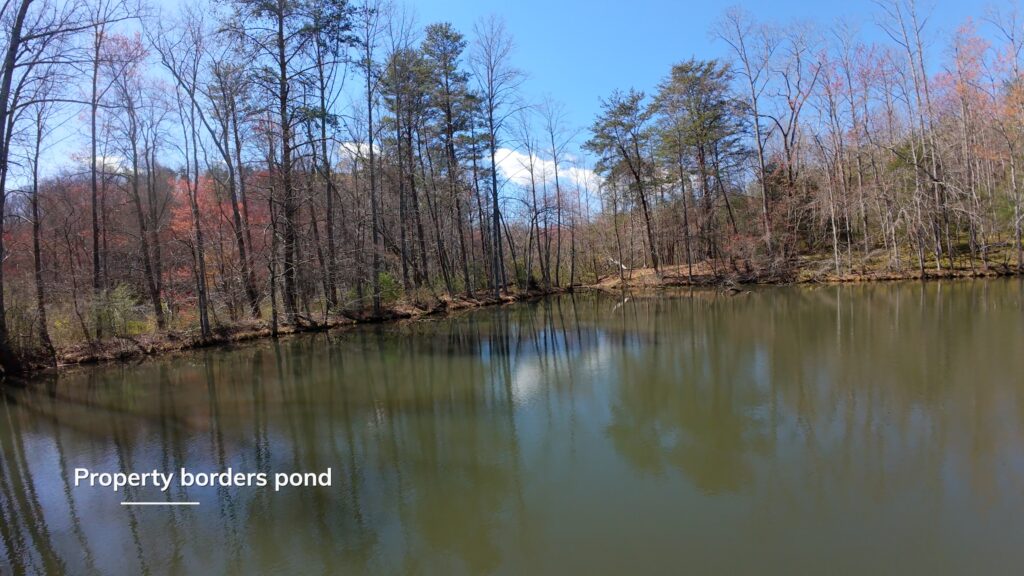
- Several springs on property
- $100,000+ timber value
- Long range views (leaf off)
- Several potential building sites
- Soils suitable for septic systems
Distances (click to access)
- 3 miles to Interstate 77 @ Zephyr Road Exit
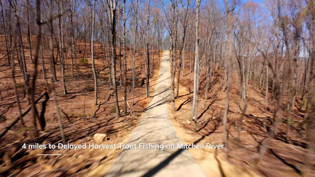
- 4 miles to Delayed Harvest trout Fishing on Mitchell River
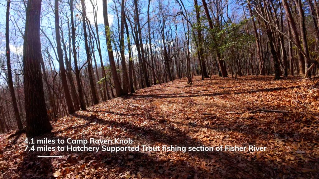
- 4 miles to Camp Raven Knob
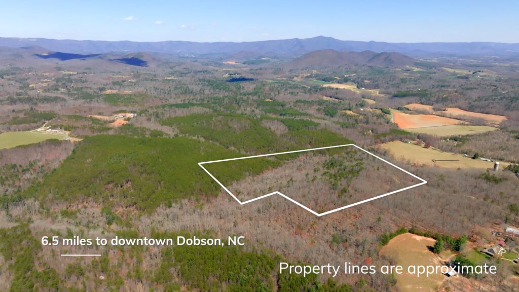
- 6 miles to downtown Dobson, NC
- 7 miles to Hatchery Supported trout fishing section of Fisher River
- 9 miles to Fisher River Park
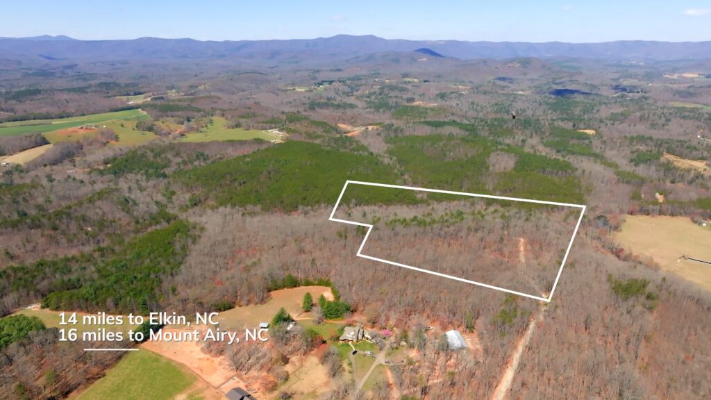
- 14 miles to Elkin, NC
- 16 miles to Mount Airy, NC
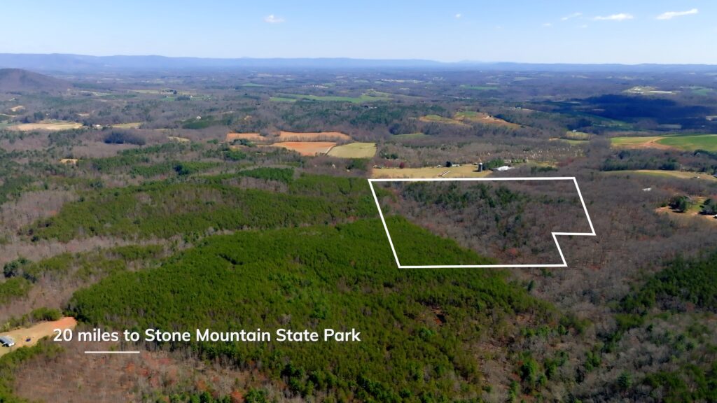
- 20 miles to Stone Mountain State Park
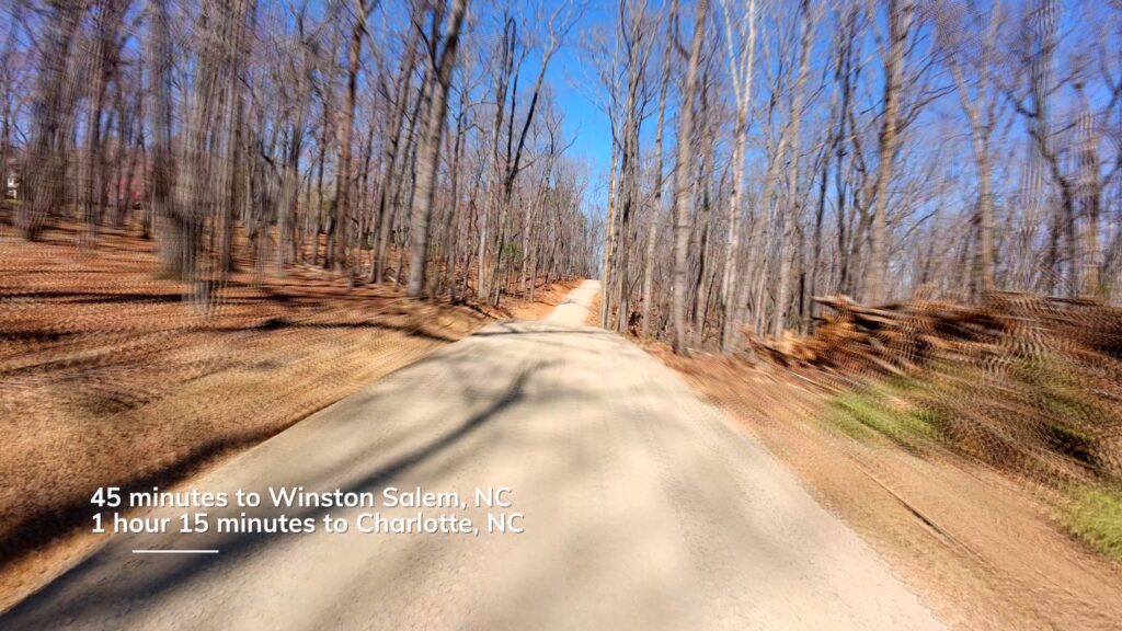
- 45 minutes to Winston Salem, NC
- 1 hour 15 minutes to Charlotte, NC
Property Maps & Attachments (click to access)
- Aerial Photo
- Aerial with Contours Map
- Vintage Topography Map
- Soils Report
- Boundary Survey
- Septic Permit
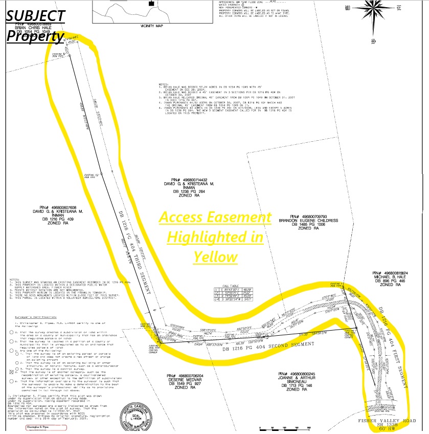
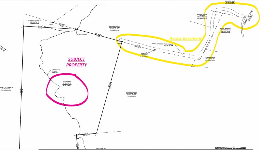
- Access Easement Survey
- Access Easement Description
- Location Map
- Google Map
Directions & Coordinates
From Fisher Valley Road turn on Shadowood Trail (private road sign) and continue on Shadowood Trail 0.25 miles. Turn right and continue on the new 2,100 ft long gravel drive. From here use the free, LandID interactive map (available above) on your smartphone to help navigate the property. You must download the free LandID app on your phone in order to see where you stand on the property/interactive map.
Driveway Entrance GPS Coordinates 36.4305, -80.8101
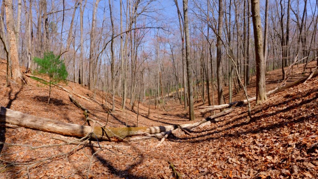
Property Photographs


Contact
JOHN SHIPLEY
336-497-0749
info@theshipleyco.com
DISCLAIMER:
Information taken from reliable sources and thought to be correct. Potential buyers should perform their own due diligence and verify all information.
56.6 Acres Surry County, NC